Gotta Fly Flying &
Driving Directions

Gotta
Fly Aviation
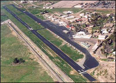
Flabob Municipal Airport
4130 Menses #8
Riverside, California 92509
Phone: (909) 778-0255
E-mail: larrylubak@gottaflyaviation.com
Click here or the on Cessna above
for KRIR and AirNav.Com
Flabob Airport Information:
Latitude/Longitude: 33-59-23.052N
/ 117-28-38.165W
33-59.38420N / 117-24.63068W
33.9897367 / -117.4106014
(estimated)
Elevation: 764 ft. / 233 m (estimated)
Variation: 14E (1985)
From city: 3 miles NW of central
business district of the associated city.
Airport Services
Fuel available: 100LL 80
Parking: tiedowns
Airframe service: MAJOR
Powerplant service: MAJOR
Bottled oxygen: NONE
Bulk oxygen: NONE
Runway Information
Runway 6/24
Dimensions: 3200 x 50 ft. / 975 x 15 m
Surface: asphalt, in good condition
Runway edge lights: non-standard
NSTD MIRL; ONE RED/GREEN LGT EACH SIDE OF THLD. RY 24 FIRST 330 FT UNLGTD.
RUNWAY 6 RUNWAY 24
Traffic pattern: left left
Markings: basic, in fair condition basic, in fair condition
Runway end identifier lights: no no
Obstructions: 80 ft. trees, 1800 ft. from runway, 20:1 slope to clear
27 ft. trees, 700 ft. from runway, 100 ft. right of centerline, 18:1 slope
to clear
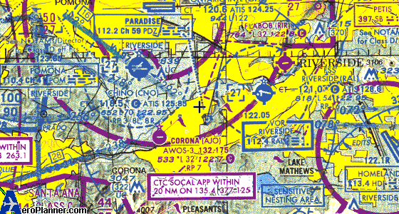
* This sectional was taken from aeroplanner.com,
and is NOT to be used for flying purposes. Gotta Fly is not liable
nor responsibility for the accuracy and currency of the chart referenced above.

Click here or on the
Car above for Mapquest.com
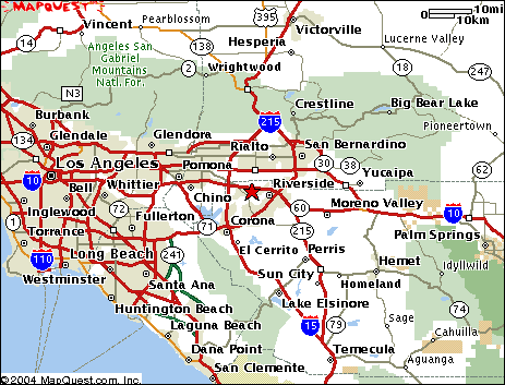
* These maps were
taken from mapquest.com and airnav.com, and are NOT to be used for driving or flying purposes.
Gotta Fly is not liable nor responsibility for the accuracy and currency
of the map or chart referenced above.